
Lake Township ZIP Code Coverage
The following coverage table preserves the evidence and limits in the county and township sources. It should not be read as a current USPS boundary file. The 2011 Stark County ZIP reference is historical context; the live USPS address lookup is the appropriate test for a specific street address.
| ZIP code | Areas covered | Post office or postal locality | What the evidence supports |
|---|---|---|---|
| 44630 | Greentown P.O. Boxes and Lake Township context | Greentown postal locality | Use as a PO Box and postal reference, not a complete geographic boundary. |
| 44632 | Hartville and Lake Township | Hartville postal locality | A core township postal identifier that exceeds Hartville village limits. |
| 44685 | Uniontown and Lake Township | Uniontown postal locality | A core township postal identifier that crosses into Summit County. |
| 44720 | Greentown, Hartville, Jackson Township, Lake Township, North Canton, and Plain Township | Shared postal area; North Canton label often appears | Shared geography, not a reliable township, school, or tax-jurisdiction label. |
| 44721 | East Nimishillen Cemetery has a Canton postal address | Canton postal locality | A township facility can use this ZIP; no broad Lake Township coverage claim is supported. |
These entries reflect the county's 2011 ZIP table and local records context, not a promise that a ZIP is assigned to every point in Lake Township. The township's historic and present community names are useful clues, but the physical parcel and taxing district decide which governmental recordkeepers apply.
Verify Lake Township ZIP Codes
Use the USPS ZIP Code Lookup live for a particular physical address. Enter the complete address and treat the result as the current delivery-oriented check. It is more reliable than extending a mailing-city label across a road, cemetery, township edge, or subdivision. This matters especially where Hartville and Uniontown wording appears outside the incorporated village or township area.
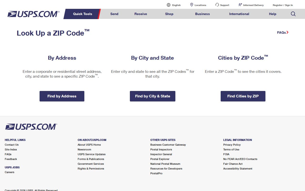
The USPS result answers a postal-address question. Follow it with a county parcel search when the question is about township jurisdiction, ownership record, tax district, or a legal description.
Lake Township ZIP Code Boundaries
Hartville 44632 and Uniontown 44685 are the core postal identifiers encountered in Lake Township records, but neither is a municipal boundary. Lake Township Hall uses Hartville 44632. Lake Community Branch and several township cemetery sites use Uniontown 44685. The township newsletter adds the operational warning: the Uniontown ZIP extends beyond the township and police-district boundary and crosses the Summit County line; the Hartville ZIP extends well outside Hartville village toward Uniontown, Marlboro Township, and Portage County.
That overlap affects practical record routing. A road address with a Hartville or Uniontown mailing city may still require confirmation through the Stark County property record, map, and tax district. Conversely, a nearby address with the same postal city can sit in another jurisdiction. Use the address as a starting point, never as the conclusion.
Stark County's communities page describes Lake Township as a 33.5-square-mile northern Stark County township that contains Hartville and unincorporated Cairo, Greentown, Uniontown, and historic Aultman. The county presentation is a useful geographic orientation, while the parcel map resolves the individual property.
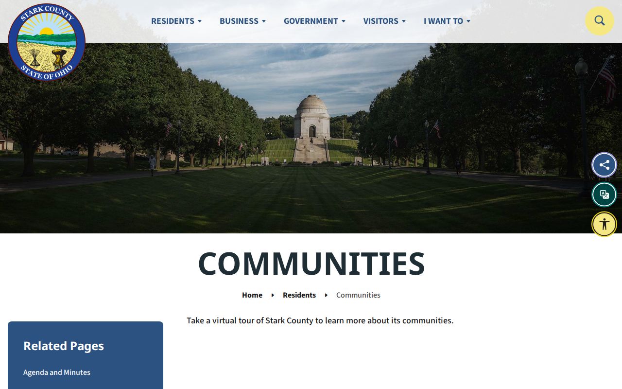
Seeing the communities together helps explain why one Lake Township ZIP code directory needs several postal labels without treating those labels as interchangeable governments.
ZIP Filters in Stark County Property Records
Stark County Real Estate Search is the ZIP-capable official property route after agreement to its disclaimer. Its Basic Search and Advanced Search lead to parcel information, and GIS/Map Search connects selected records to a map. The results are parcel and record-owner information, not a list of every occupant in a ZIP code. Record each returned parcel number, situs, tax mailing block, legal description, and tax district before using a result as a research lead.
| Address Number | Text field used with street information when narrowing a physical address. |
|---|---|
| Street | Use the street field; the guide recommends omitting a suffix for a broader match. |
| Direction | Preserve directional information such as NE or NW when the address requires it. |
| ZIP | Advanced-search criterion. Multiple ZIP values are comma-separated with no spaces. |
| Group | Advanced selector for Residential/Agricultural or Commercial property categories. |
| Add / Edit / Remove | Controls used to build or revise a multi-criterion advanced search. |
| GIS map link | Opens the selected parcel's map and nearby geometry for geographic review. |
The county's parcel example for PIN 1980039 shows a Hartville 44632 situs with Lake Township tax-district context. It is a useful example of why the postal line and the governmental record must be read together.
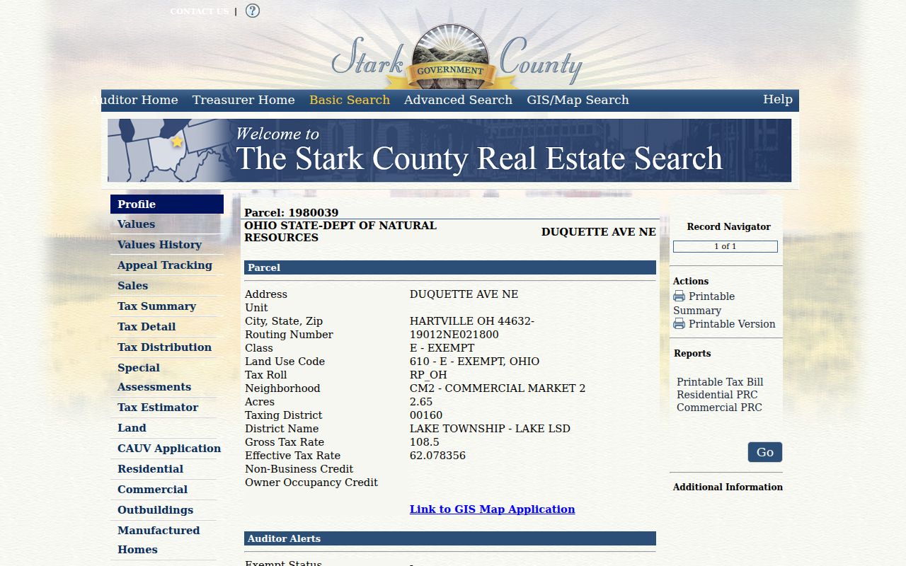
The parcel profile is the next verification layer after a ZIP code lookup: it preserves the physical situs, tax mailing contact, legal description, and tax jurisdiction as distinct fields.
Lake Township ZIP Code Leads
No public source reviewed supplies a complete ZIP-wide resident roster. A careful ZIP code directory workflow narrows a geographic question and then verifies each individual parcel or named record against the relevant custodian.
- Confirm the physical address and current ZIP with USPS, including the street number, direction, and postal city as returned.
- Use Stark County Real Estate Search with address fields or Advanced Search ZIP criteria, and compare every returned result with the map.
- Open the GIS map link to inspect parcel geometry and the relation between the address, township boundary, street, and nearby parcels.
- Save the parcel number, situs address, tax district, and legal description, then use the Recorder or Tax Map route only for the defined property question.
- For a named voter confirmation, use Ohio's individual voter lookup with first name, last name, and Stark County; it is not a ZIP-wide browse tool.
Once a question is narrowed to an address, the Lake Township By Street explains the street-level parcel and records process. For a prior household or ownership question, follow the historical chain on Past Residents rather than inferring a household from a present ZIP filter.
Lake Township ZIP Code Address Forms
The same property can carry a physical location, a delivery contact, and a legal land description. Keep all three when a ZIP search becomes a property-history question. A mismatch is often useful evidence of how the record is organized, not an error to smooth away.
- Situs address
- The physical location displayed on the parcel card. It usually includes the city, state, and ZIP used for the property location.
- Tax mailing address
- The contact address for tax notices. It can be a P.O. box, a trustee or agent address, or an out-of-area address, so it is not proof of physical occupancy.
- Legal description
- The lot, block, subdivision, section, or acreage wording used in deeds and tax maps. It may survive a street or numbering change.
- ZIP and ZIP+4
- A ZIP code directs mail to a delivery area. ZIP+4 adds a more specific delivery segment; neither term defines a township boundary or a property title.
- PO Box ZIP
- A postal designation used for box delivery. It should not be assumed to describe a surrounding physical service area.
- Carrier route
- A postal delivery-sequence grouping. Treat it cautiously as mail-routing information, not a governmental boundary or a roster of people.
Keep the three forms together when a result moves from mail delivery to a parcel or deed question. A ZIP or tax-mailing line can help locate a record, but the situs, legal description, and tax district establish which property is being reviewed.
Lake Township ZIP Code Numbering
Stark Regional Planning's house-numbering procedure says a number must be assigned before a new building permit and states a $15 fee per address. Applicants need a legal record. An unplatted site needs a map that shows driveway and building placement, and condominium units must be declared through the Auditor. Sewer or septic coordination can also be part of the process.
Congress Lake, Lake Cable, and Willowdale have an extra documented condition: the applicant must provide a subdivision-administrator letter before address assignment can proceed. This is an administrative step, not evidence of a public subdivision roster. If an older or new address is confusing, compare its legal description, plat, Tax Map material, and official number instead of assuming a ZIP code preserves the complete address history.
Lake Township ZIP Code Records
A ZIP code sends mail; it does not decide the proper custodian. Lake Township records can concern zoning, trustees' minutes, fiscal material, and township requests. Stark County property systems hold parcel and tax context, the Stark County Recorder holds recorded deeds and other instruments, and the Probate Court has marriage, estate, and historical probate pathways. The question and physical jurisdiction decide which office should be contacted.
For a Lake Township public-records request, the governing access law is the Ohio Public Records Act, Ohio Revised Code R.C. 149.43. It allows inspection and copies within a reasonable period, subject to applicable exceptions. Phrase the request around a defined record, property, date range, or public office rather than asking staff to create a new ZIP-sorted directory. This respects the distinction between a postal clue and the record actually maintained by the custodian.